|
| *****SWAAG_ID***** | 749 |
| Date Entered | 25/08/2013 |
| Updated on | 26/08/2013 |
| Recorded by | Tim Laurie |
| Category | Mining Related |
| Record Type | Mining |
| Site Access | Public Access Land |
| Record Date | 23/08/2013 |
| Location | Moor House National Nature Reserve. Rough Sike. |
| Civil Parish | Forest and Frith |
| Brit. National Grid | NY 756 328 |
| Altitude | 550m |
| Geology | 'Netherhearth Veins: Around the headquarters at Moor House, a complex of intersecting E-W,NNW and ENE Veins were worked from shallow shafts, open cuts and adits.'
Source: The Geology of Moor House.' Monographs of the Nature Conservancy No 2,page 101. |
| Record Name | Netherhearth lead vein complex and bale at Rough Sike, Moor House. |
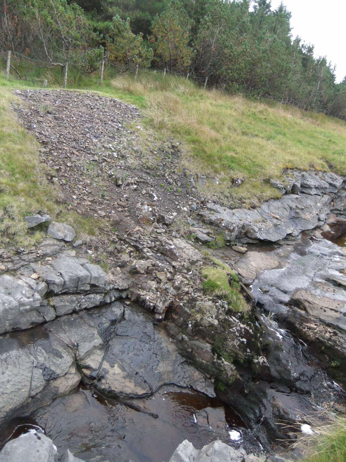
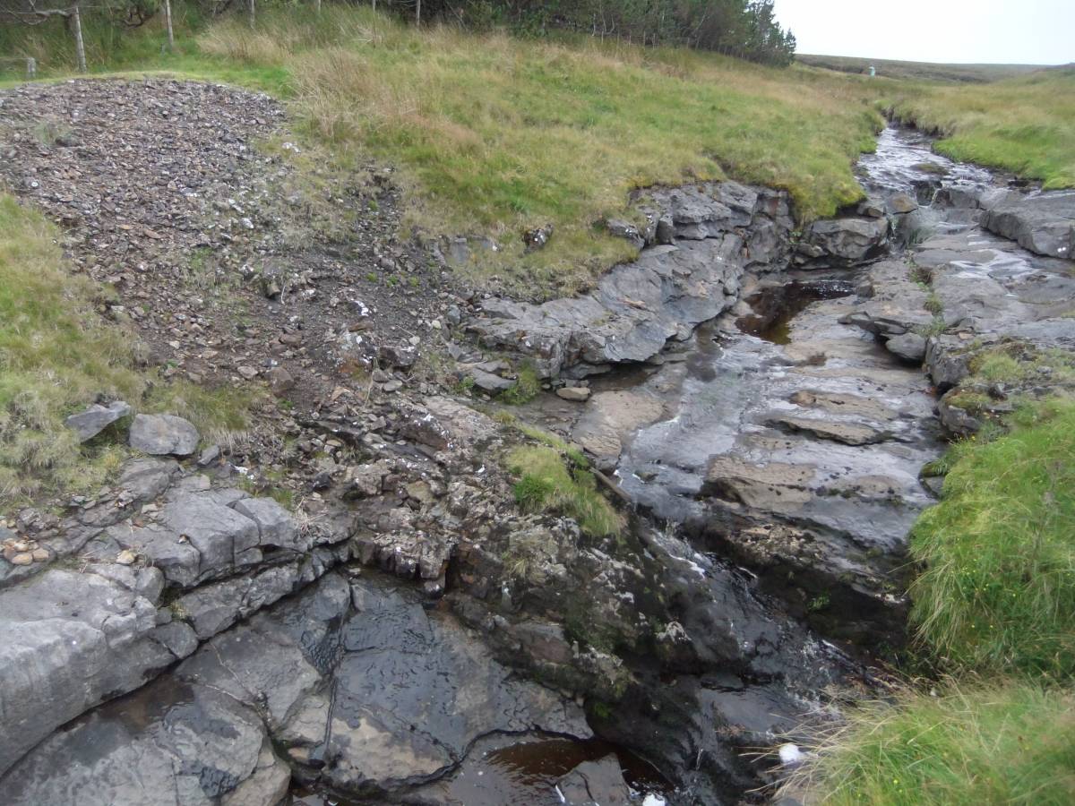
| Record Description | Lead vein 450mm wide clearly visible as very dark brown igneous dike which contrasts with the grey limestone (the Tyne Bottom Limestone) where the vein crosses the bed of Rough Sike. One of two similar vein exposures here. This lead vein has been worked on the eastern side of the stream where lead slag marks the site of a probable Lead Bale.
This records a rare instance of an unworked lead vein visible in the stream bed of Rough Sike. |
| Additional Notes | The minerals present include purple fluorite, quartz, calcite, galena and sphalerite (zinc blende.
The extensive surface workings and numerous lead bales on this vein complex will be the subject of a separate record.
Further photographic details of the mining remains in this area are recorded as SWAAG Record No 750. |
| Image 1 ID | 4661 Click image to enlarge |
| Image 1 Description | Lead vein 450mm wide clearly visible as very dark brown igneous dike which contrasts with the grey limestone where the vein crosses the bed of Rough Sike. | 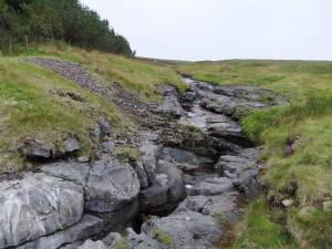 |
| Image 2 ID | 4662 Click image to enlarge |
| Image 2 Description | Lead vein 450mm wide clearly visible as very dark brown igneous dike which contrasts with the grey limestone where the vein crosses the bed of Rough Sike. | 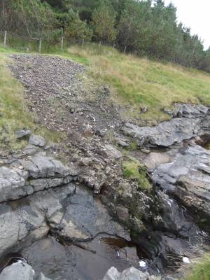 |
| Image 3 ID | 4663 Click image to enlarge |
| Image 3 Description | Lead vein 450mm wide clearly visible as very dark brown igneous dike which contrasts with the grey limestone where the vein crosses the bed of Rough Sike. | 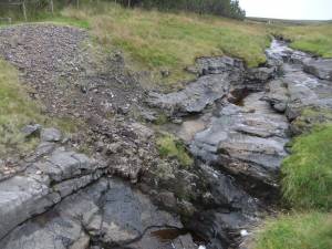 |